

State Corporation Commission Utility Maps Digitization
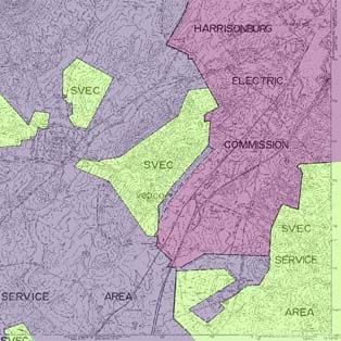
Researchers at CGIT are digitizing approximately 1,400 utility coverage area maps for the state of Virginia, under a contract with the State Corporation Commission (SCC). The project is intended to turn the existing hard copy maps into digital versions that will streamline SCC’s activities.
The maps show coverage for electric, gas, water utilities, and transmission lines. For each of these, CGIT is preparing a geodatabase, as well as digital maps detailing service areas and including attribute information.
Another deliverable of this project will be the integration of a viewable authorization document or certificate in the maps. When a utility provider is granted the authority to provide service to a geographic region, an authorization certificate is issued. This certificate notes the service type (electric, natural gas, or water) and the geographic area that the utility has been authorized to serve. Once CGIT completes the utility map digitization project for SSC, the certificate granted to utility providers will be viewable with the coverage areas.
See our Previous Projects
