

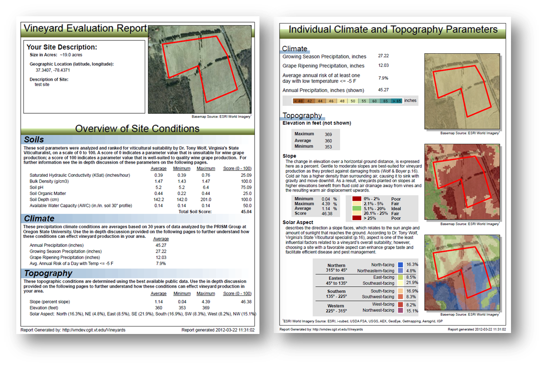
GIS-based Vineyard Site Evaluation Tool
Research Status: Funded
Date Began: 11/2010
Date Ended: 11/2015
Key Personnel: Peter Sforza, Thomas Dickerson, Erica Adams, Kyle Schutt, Ben Logan
This is a USDA-SCRI funded project to develop a public web application with a GIS-based vineyard site evaluation tool incorporating climatic, topographic, and edaphic parameters. This application allows end users to select their site and use a geoprocessing tool to produce a site suitability summary report. This project requires the creation of many data layers, and techniques such as web mapping, climatological interpolation, and high performance computing.
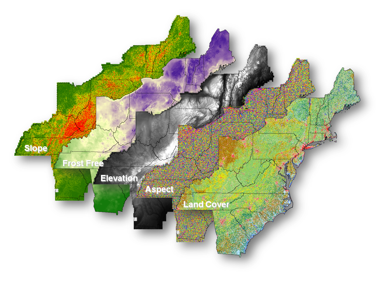
The general approach is to generate state-wide digital maps reflecting “basic factors” such as historical (30-year) macroclimate (growing season length, heat accumulation, and growing season average temperature), mesoclimate (absolute elevation, slope, aspect or solar potential), soil properties and current land-use. These factors will be used to create high resolution digital maps of vineyard suitability based on a ranking score system. A second set of state-wide maps will be generated based on “risk factors” for grape production in a given region, including winter freeze, spring and fall frost occurrence, ripening period rainfall, Pierce’s disease, and the potential for phenoxyacetic herbicide drift. These maps will be customized for each state, because the risk factors vary from one region to another.
Vineyard site evaluation reports are created automatically by interpreting publicly available data as it applies to vineyard suitability. The application also captures information from users in order to better serve user needs whether they are vineyard owners, consultants or simply curious wine fanatics.
See our Previous Projects
