

Geospatial Support for Chimpanzee Studies
CGIT worked with Assistant Professor Taranjit Kaur of the Virginia-Maryland Regional College of Veterinary Medicine to integrate socio-ecological research and conservation medicine to analyze chimpanzee activity and health. The goal of the project was to develop GIS modeling programs that could be used to predict chimpanzee behavior and health.
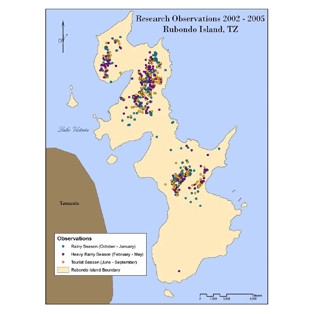
Researchers used data collected from 2002 to 2005 to develop the beginning stages of a GIS model for predicting chimpanzee movement, habitat preference and disease transmission on Rubondo Island, where nonnative chimpanzees had been introduced. Researchers created datasets on island vegetation and chimpanzee sightings, vocalizations, signs, nests, and home ranges. By combining the locations of vegetative communities with knowledge and data on the home range of chimpanzees on the island, researchers believe they eventually will be able to predict behaviors using GIS modeling.
See our Previous Projects
